Navigraph adds FAA Sectionals to Charts

Navigraph has added US Federal Aviation Administration (FAA) sectional charts to its Navigraph Charts platform in an update which it says will enable users to “explore the U.S. with higher realism than ever before.”
Sectional charts are primarily used by VFR pilots, and display information on the ground below, including landmarks, roads, railways, and topography, as well as navigational information, airports, controlled airspace, restricted areas, and obstructions.
In its announcement, Navigraph said: “Sectional charts aren’t just random squiggles on paper; they’re the wingman every flight simmer wants by their side.”
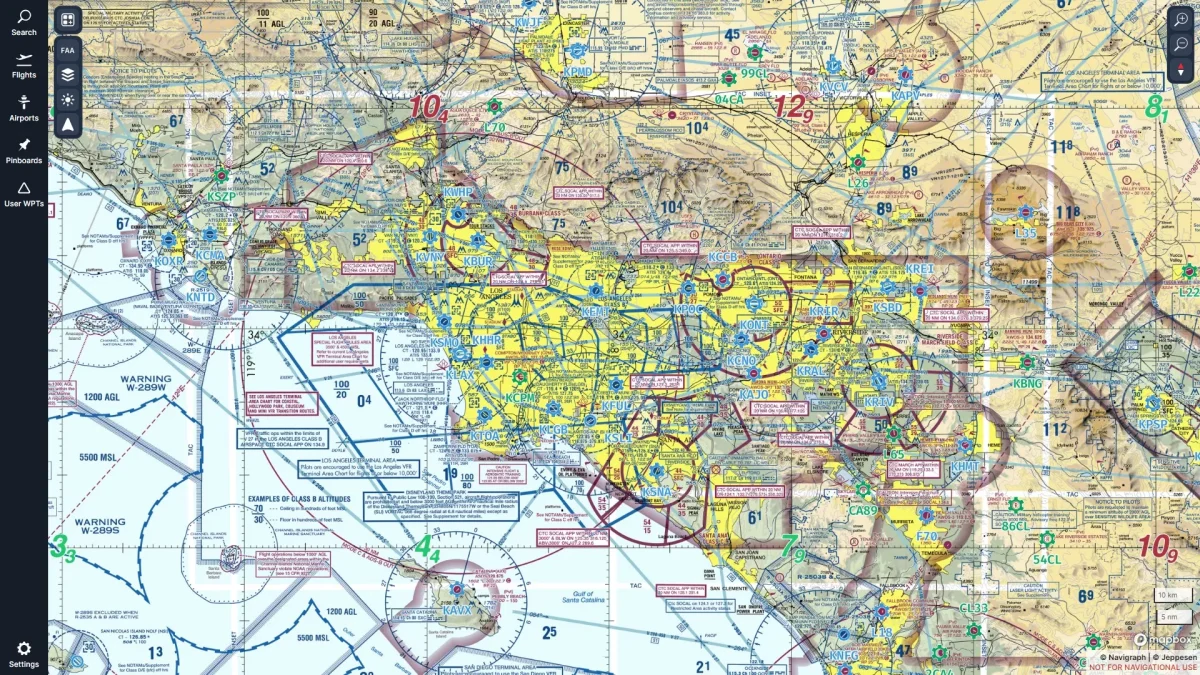
Sectional charts also include Terminal Area Charts (TACs). These are depictions of specific metropolitan areas covered by Class B Airspace, and provide more detain than the standard sectional chart.
The charts are integrated into Navigraph’s system, including the In-Game Panel for MSFS, and can be enabled from within the ‘Map Presets’ menu. Navigraph has published a video tutorial showing users how to use this latest update, linked below.
