Navigraph previews VFR charts for the upcoming version of its popular service


Navigraph provides a key service for simmers looking to bring their flying experience in Flight Simulator to the next level. By offering updated aviation charts based on real-world operations, Navigraph greatly helps to increase the levels of realism in the simulator. For those wondering about the next version of Navigraph Charts, there’s a particularly exciting preview this week for a much-awaited feature that will soon hit the service: VFR charts!
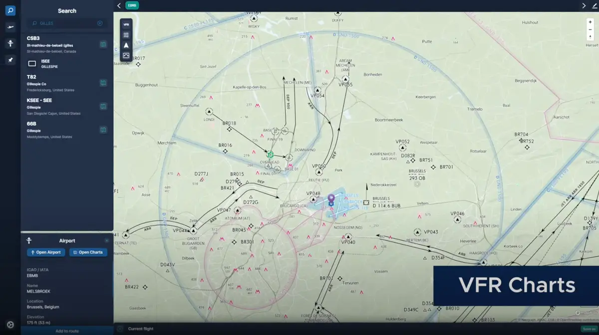
Navigraph Charts 8 is currently in very active development. In fact, it’s in final beta testing with over 1,000 users, who are putting the new features through their paces ahead of a release that should happen soon. Charts 8 will come with all the functionality users know and love from Navigraph, but now augmented with the addition of VFR charts with visual reporting points, patterns, transition routes, zones to avoid, and much more.
Along with this new chart type also come new data layers, enabling users to activate terrain views, roads, railroads, landmarks, and obstacles. These will be important to plan your flights under visual flight rules, where terrain awareness is crucial during all stages of flight.

Navigraph detailed some of the upcoming features and even shared a very cool preview video showing the VFR charts function in action. Notice the airspace visualization, transition routes, traffic and holding patterns, or the objects and landmarks views. Looks exceptional!
Navigraph has been a must-have for simmers flying in IFR, and it now seems like it may become a highly recommended tool for VFR fliers as well. Navigraph has further plans for the product after the next release, with a roadmap that includes additional data layers and new capabilities like navlogs, annotations, and more.
For now, the timing for the release of Charts 8 is still unestablished, but it should still take a few weeks of further testing before it’s ready to come out. Expect to hear further details soon!
Navigraph Charts 8 feature list:
- All basic functionality in the existing Charts apps, plus…
- VFR charts with visual reporting points, entry/exit routes, patterns, transition routes, flyways, avoid-overflying zones
- New data layers with terrain, roads, railroads, landmarks, obstacles, high points
- Data driven charts with 3D globe projection, with items configurable and seamless zoom down to airport/taxiway/gate level, and support for track-up moving maps
- Improved airspace visualization with clearer altitude restrictions
- Pinboards with auto-pinning of procedure charts
- Drag-and-drop route construction
- Airport weather (METAR/TAF) and runway winds