FSXmap is a very useful browser-based interactive map for Flight Simulator

Sometimes a new tool comes along that brings both simplicity and usefulness to whatever it tries to accomplish. We have seen a few good ones for MSFS, and today we present you FSXmap.com, one of those utilities that we believe can be a great new addition to your Flight Simulator toolbox!
FSXmap.com is an online map, completely free to use, that provides information about all available airports in Flight Simulator, while also being able to connect to the sim and pinpoint your precise location in real-time.
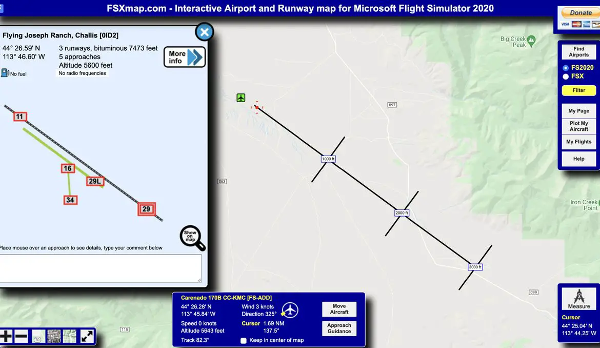
Airport and runway information is easily accessible through a click in the respective icon on the map (green for bigger airports, yellow for smaller ones). A pop-up window then shows a graphical representation of the airport layout and its available runways, and if you click on one of the runways, a new window will show more detailed information such as altitude, runway length, ILS frequencies, and more. Extremely useful!
Besides the built-in information provided by FSXmap, each airport panel has also direct links to other well know platforms where additional information can be found, such as FlightAware, SkyVector, AirNav and Wikipedia.
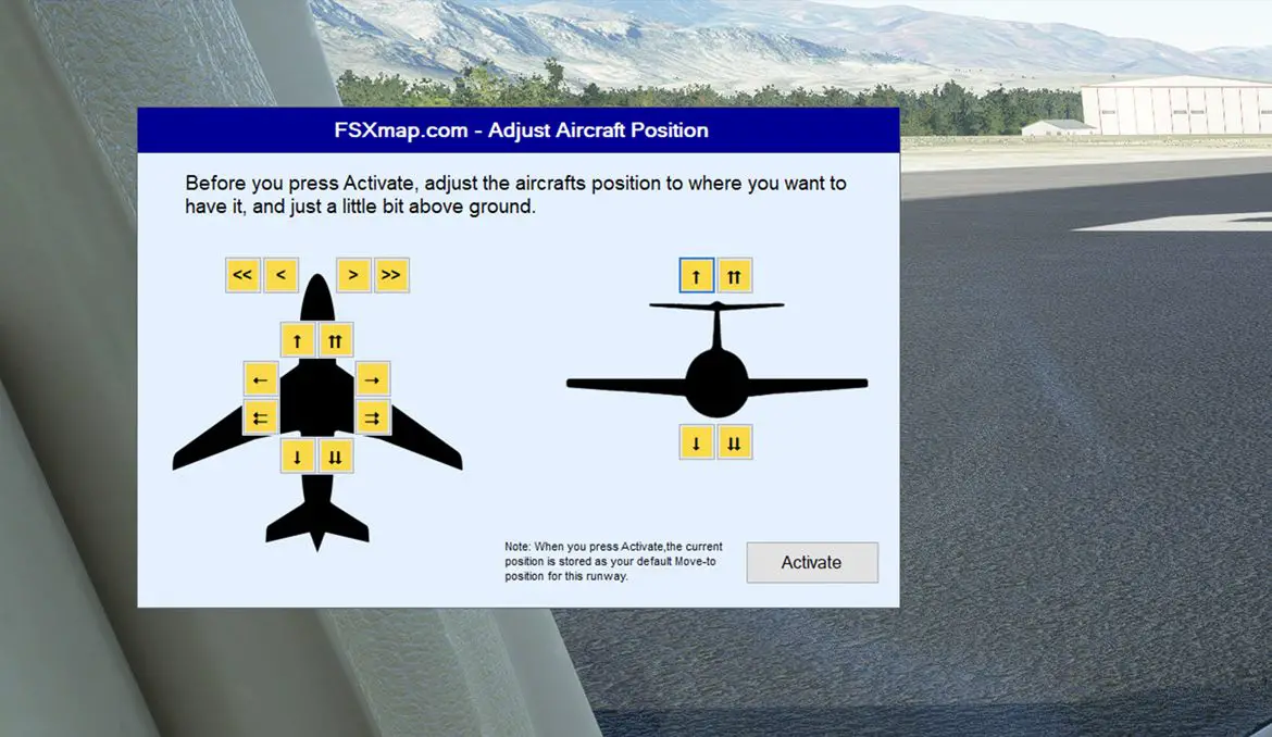
Besides being able to access such useful airport data in an easy way, FSXmap is also able to connect directly to MSFS and show real-time information about your location, speed, heading, altitude, and so on. You can even select an approach to an airport of choice, and get ILS and VASI guidance to reach the runway. And even more, it enables you to change the position of your aircraft, teleport it to the other side of the world or make small adjustments to your current position.
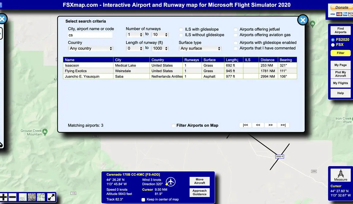
Another particularly useful feature of this cool little website is the ability to search and filter all the airports. You can, for example, get a list of all the US airports with grass strips that are less than 1000 ft long. Or see just airports that offer jetfuel. This is very useful to find those tough bush strips and go on some challenging STOL adventures!
This all comes with a very straightforward setup. Just login to the site using your Google account, for instance, and you will get a unique number ID. Then, download and run the small server app, insert your ID there, and fire up MSFS. Now, after clicking “Plot my Aircraft” in FSXmap, you will see your position in the world, and enjoy the added features of having both the map and the simulator connected.
This setup enables one final trick: because it connects over a network, you can effectively have FSXmap opened on your iPad or smartphone, for instance, or even on a laptop beside your desktop. A very effective solution for those with only one monitor connected to the PC that is running Flight Simulator.
All in all, FSXmap is a very effective and easy-to-use platform, which gives useful information for virtual pilots while also being very easy to use and get started with. Highly recommended!
